
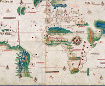
Jan Hugen van Linschoten is not a name that figures in cartography like Mercator or Fra Mauro, but in many ways he is just as important, if not more so, to the modern globalised world.
He travelled extensively along the East Indies’ regions under Portuguese influence and served as the archbishop’s secretary in Goa between 1583 and 1588. He is credited with publishing in Europe important classified information about Asian trade and navigation that was hidden by the Portuguese. In 1596 he published a book, Itinerario (later published as an English edition as Discours of Voyages into Ye East & West Indies) which graphically displayed for the first time in Europe detailed maps of voyages to the East Indies, particularly India. During his stay in Goa, abusing the trust put in him by his employer, Jan Huyghens meticulously copied the top-secret charts page-by-page. Even more crucially, Jan Huyghens provided nautical data like currents, deeps, islands and sandbanks, which was absolutely vital for safe navigation, along with coastal depictions to guide the way. The publication of the navigational routes enabled the passage to the East Indies to be opened to trading by the Dutch, French and the English. As a consequence, The Dutch East India Company and British East India Company would break the 16th-century monopoly enjoyed by the Portuguese on trade with the East Indies.

 In 1879, Thomas Edison (left) managed to produce the first usable incandescent electric light bulb. He did this on the back of patents he had purchased some years earlier from Henry Woodward and Matthew Evans, whose patent for the invention had been granted in 1875. What Edison managed to do was to create a filament that would burn for longer: 40 hours or so in its initial form. A year later he had a lightbulb that would last for 1200 hours. The growth in usage was initially slow, as with many such technologies: in 1885, around 300,000 light bulbs were in use, and by 1914, the US had around 85 million lamp sockets.
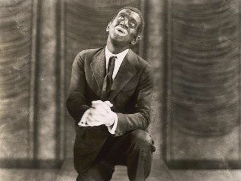 Today, October 6th is the day in 1927 that “The Jazz Singer” opened, with Al Jolson in the title role. The Jazz Singer wasn’t the first film with sound, but it was the first full-length film with synchronized dialogue, even if only a few minutes. But it changed not just Hollywood, but the whole entertainment business: as the actor leading in a stage production of The Jazz Singer said: